Sunday, 23 April 2017

DOING THE DARTMOOR WAY

FOLLOW THE BLUE LINE (ROUGHLY)
BURNT OUT CHURCH NEAR CHURCHILL'S FARM
BY HAYTOR ROCK
BRIDGE OVER BECKA BROOK
FARMER WITH A SENSE OF HUMOUR
OXENHAM ARMS IN SOUTH ZEAL
TOUGH WALKING - ONE OF US MIGHT NEED THIS SOON
RUBY MAKES FRIENDS EASILY
Just outside the gate of Churchill's Farm is the burnt out shell of the Church of the Holy Trinity, apparently destroyed by an arsonist. Stories of evil and devil worship are associated with the church, which may explain why it was attacked. Only the tower and spire have been restored, but the church is still consecrated and useable for open-air services.

Leaving Churchill's Farm, we drove down to Northgate House car park. The hotel had kindly agreed that we could leave the car here for a week as we walked the Dartmoor Way.

The Dartmoor Way is a 90 mile long-distance circular walking route that visits many of the towns on the edge of Dartmoor National Park as well as passing through many moorland areas. Rubi and I would undertake this route in an anticlockwise direction over a period of a week, taking a tent and wildcamping on some nights.

We started our walk by passing through the grounds of Buckfast Abbey, crossing the Dartmoor Bridge and heading north to Ashburton. Near to Ashburton we met a couple who were navigationally displaced so we guided them to the town centre where we took our first break.

The route of the Dartmoor Way assumes that you will need a B&B at the end of each day, and the next stop was Bovey Tracey. Rubi, however, suggested that since we would not be staying there we could perhaps improve upon the route by going somewhere more interesting. Thus, we changed our direction somewhere around Sigford and headed straight for Haytor Rocks. I was pleased to be off the roads, farm tracks and footpaths and into open moorland at last.

It was starting to get late by the time we reached Haytor Rocks, but we continued on past Haytor Quarries to reach the north side of Haytor Down where we were permitted to wildcamp. Rubi found a nice flat spot protected from the wind by gorse bushes.

It was rather cool overnight so we were pleased to be greeted by the sun streaming into the tent in the morning.

We had departed from the 'official' Dartmoor Way and now had to rejoin it, which involved a difficult trek down Black Hill and through the scrub of Trendlebere Down until we found a linking path in Houndtor Wood that took us to a bridge over Becka Brook.

Lunch was enjoyed on the village green North Bovey, but were unable to replenish our water. We continued on to Moretonhampstead before deciding that suitable camping sites near Chagford, our target for the day, would be unreachable in daylight. Thus, we decided to forego the section of the Dartmoor Way that took us past Castle Drogo and instead walk more directly to Nattadon Common, just south of Chagford, where we were able to settle down for the reasonably comfortable night.

In the morning we took the short walk into Chagford to replenish our food stocks, then followed the Dartmoor Way north-west to charming South Zeal, famous for the 840 year old Oxenham Arms and the Methodist Chapel located in the middle of the road, and on the Sticklepath where we ate lunch and enjoyed a pint each of lime and soda at the Taw River Inn.

The afternoon walk between Sticklepath and Okehampton via Belstone was particularly pleasant, especially since we were under no pressure, having booked a night in Okehampton's Fountain Inn. Absolute luxury after two nights in the tent! Also, having existed on cold food for two nights, we were pleased for the opportunity to pig out at the local Wetherspoon's. Rubi had a large mixed grill (but she did share much of it with me).

HAMPSHIRE WALKING GROUP IN DEVON

WHOOPS!
AMAZING BUCKFAST ABBEY
INSIDE BUCKFAST ABBEY
HAMPSHIRE WALKING GROUP
TREE NYMPH
TREE MONSTER
HAMPSHIRE WALKING GROUP ON SHARP TOR
THIS ONE MUST HAVE JUMPED OVER THE FENCE
The week didn't start that well. I gave the car some cosmetic surgery by scraping the passenger side doors against a post. Sadly, the procedure was unsuccessful as it didn't improve the car's looks. On the positive side, the car is still fully functional and safe to drive, and the chances of anyone wanting to steal it had diminished somewhat.

Anyway, having got over that little trauma, on Thursday (the day before Good Friday) Rubi and I headed down to Buckfastleigh to join other members of the Hampshire Walking Group who were gathering there for an Easter long-weekend of walking. Many were staying at 'Churchill's Farm', the local campsite, and Rubi assumed we would be camping there too. As a surprise, however, I had booked our first night at Northgate House, a superb hotel located in the grounds of Buckfast Abbey.

We arrived just after 10.00am, giving us time to look around the Abbey before the first group walk at 1.00pm. The Abbey is suburb, and the story of it having been built on the foundations of an earlier one by 6 monks who dedicated 30 years of their lives to the task is incredible, especially when only one had any previous building experience.

At around midday we strolled down to Buckfastleigh village centre where we joined the other walkers at The Globe Inn. The walk itself was a little over 8 miles and took as alongside the River Dart before heading West to Holne. Our return route followed a part of the Dartmoor Way, which was coincidental because this was the long distance path which we were planning to commence on Saturday. I'll explain more about that in the next post. Anyway, after a shower and supper (the latter prepared and eaten in Buckfastleigh village car park) we rejoined the walking group in the Globe.

The following day, after enjoying Buckfast Abbey's excellent breakfast, we paid our bill and drove to a car park at New Bridge, just north of Holne, to join another group walk of nearly 10 miles. The route followed the River Dart north as far as Dartmeet, then looped back across Yartor Down and Sharp Tor before returning to the car park via the Two Moors Way.

On our second night we car-camped at Churchill's Farm. Richard, one of our fellow walkers, invited us and another walker, Fiona, to join him for a barbecue, which was definitely a superior option to spending the evening in the local pub. Richard's generous G&T's provided excellent lubrication for the evening's conversation.

In the morning we arose in time to bid farewell to our friends as they departed for their third day of walking. We, however, had our own plans.

Thursday, 23 March 2017

SNOWDON 'ERE

PLAS CURIG HOSTEL
SNOW NEAR FOEL-GOCH
ME & TOM ROUTE-FINDING AROUND THE OGWEN VALLEY
PAUL (ASSESSOR) & TOM: A BREAK ON OUR SCRAMBLE UP TO LLECHOG
TOM HAD TOTAL CONFIDENCE IN MY ROPEWORK
LLYN COWLYD
WILDCAMP NEAR FFYNNON LLYFFANT
REMAINS OF CRASHED BOMBER NEAR FFYNNON LLYFFANT
COMMON FROG SEEN ON NIGHT NAVIGATION EXERCISE
SUPPER OUT OF THE DRIZZLE NEAR AFON ANAFON
ALL OVER: ME, PETE (ASSESSOR) & TOM

This is an adventure for me only while Rubi was busy at work. The dates 13th to 17th March have been prominent in my mind for a while, because these are the dates I booked for my 'long time coming' Mountain Leader (ML) assessment. This is the culmination of about a decade of thinking about it, then five years ago signing up with Mountain Training (the awarding body for qualifications in walking, climbing and mountaineering). Two years ago I took a week-long training course in Snowdonia with Paul Poole Mountaineering and now I have returned to Paul for the Assessment Course.

The course assesses the skills required to lead groups in the mountains, including planning, understanding weather forecasts, navigation, safety & risk assessment, use of a rope, environmental knowledge and group management. There was only one other candidate on the course: Tom from nearby Conwy. Thus, the pair of us had the almost undivided attention of Paul and his co-assessor Pete - not much chance of our mistakes going unnoticed then!

I arrived at Capel Curig in Snowdonia on Sunday 12th, and stayed for three nights at the very smart Plas Curig Hostel. On Monday, after examining our pre-course 'homework' in the warm confines of Moel Siabod Cafe next door, Paul drove us to the Ogwen Valley for some navigation exercises. Though foggy at times, it was a surprisingly pleasant day for this time of year. Tuesday involved some scrambling practice and the assessment of our skills with a rope. Wednesday, Thursday and Friday were spent with Pete on a two-night expedition in the eastern Carneddau. This initially involved using 1:25K OS maps to navigate ourselves to a wildcamp near Ffynnon Llyffant, a lake just below Carnedd Llewelyn. After a hot supper, Pete tested our ability to navigate in the dark before we settled down for the night.

Thursday saw us navigating with less detailed 1:50K maps across some Carneddau peaks to a sheep-fold near Afon Anafon. It drizzled for a substantial part of the day and the droplets of water on my glasses made it extremely difficult to read the map at all, let alone see some of the finer details. Pete was very tolerant of my constant attempts to wipe my glasses (invariably unsuccessfully as they simply smeared) and my struggle to maintain precision. Fortunately my distance vision is fine, so I could still avoid us getting lost by simply looking over the top of my glasses whilst walking.

After a cold night wildcamping in the sheep-fold, the three of us walked out of the hills to be picked up by Paul in his car and taken back to Moel Siabod Cafe. After Pete and Paul had their pow-wow about our performance, I was pleased that both Tom and I were invited to receive our feedback together as this implied that we had both either passed or failed. Since I had seen how well Tom had performed, I guessed the news would be good for both of us. Thus, we were both congratulated on having successfully completed our Mountain Leader assessment. Handshakes all round! I thanked Pete and Paul for their excellent guidance and advice, and Tom for his good company, before departing.

It would have been a five hour drive home had I not discovered that my smartphone was missing. I normally 'check the ground, and my pockets' before leaving a campsite, but assumed that I had somehow left it in the sheep-fold. However, on driving back to where Paul had picked us up I immediately saw it on the ground where his car boot had been. It had clearly fallen out of my pocket whilst loading the rucksacks into his car. Finding it had cost me an extra hour but the phone was undamaged. Thus, having attained my ML and been happily reunited with my smartphone, I drove the rest of the way home with a broad grin across my face.

Thursday, 2 March 2017

OVER THE HILLS & FARO WAY

AN OLD WELL
SPRING WATER
CLIMBING TO ROCHA DA PENA
VIEW FROM THE TOP
MORE CLIMBING IN ALBUFEIRA
SOMEONE HAS WORN A HOLE IN THIS CLIFF
REWARD FOR THE DAY
SCULPTURE IN ALEMEDA JOAO DE DEUS GARDEN, FARO
FARO RESIDENT
KING AFONSO III (ON RIGHT)
For our last day with the car, we drove to the valley of the Ribiera (River) de Benemola, to the north east of Albufeira. We walked along one side of the river to its source, the Fonte da Benemola, where we ate our usual picnic at stone tables. We then crossed over the river where it was shallow and walked back on the opposite bank. Alongside the route we saw evidence of the farming communities that used to live in the valley - ruined dwellings, water pumps and sluices (levadas) to channel water to the fields.

On returning to the car, we next drove west a few miles to see a long rocky ridge called Rocha da Pena. We could see the ridge from some way off so it wasn't hard to find. Parking near its base, we set off walking towards it. To make the walk more interesting, we left the main path after a short while and soon found ourselves scrambling up the rough grey limestone rocks. After about half an hour we arrived at a point where we could enjoy the view before walking back down by an easier route. There was a bar near to where we parked the car so we enjoyed a drink in the day's remaining sun before moving on.

Our return to the hotel took us through Sao Bartolemeu de Messines where we picked up a pizza for supper at the Intermarche supermarket

Next morning we handed back the keys to the car. We planned to take a bus to Faro early the following day so we initially checked where Albufeira's bus terminal was before heading down to the beach to walk the cliffs again, much as we had done on our first day, but this time in the other direction. 

Clambering over the cliffs was just as much fun as it had been the first time. We came across lots of sink-holes, caves and rock arches, all shaped by sea action. The weather was sunny again and it was a great last day in Albufeira.

The following morning we caught the 8.40am bus to Faro. It travelled a very circuitous route and stopped many times before arriving in Faro at 10.10am. We had assumed Faro would be an interesting and historic place with lots to see, but were rather disappointed. For a start, it was much smaller than we had expected the principal city in the Algarve to be. There was a pretty garden with peacocks wandering about in it, a pedestrianised shopping area, the old city walls and the harbour. However, it did not take us more than a few hours to see all this. Perhaps we would have learned more about the place had the museum been open.

There weren't even any picturesque walks nearby so, once we had run out of things to do, we caught the 'Proximo' bus to the airport. This meant that we would have roughly 4 hours to wait before our 8.45pm flight, but we managed to amuse ourselves.

In spite of Faro being disappointing, our week in Portugal had been a great success and the weather had been brilliant. We were not looking forward to the much cooler weather in the UK.

Monday, 27 February 2017

CAR TOURING IN THE ALGARVE

OUR HIRE CAR
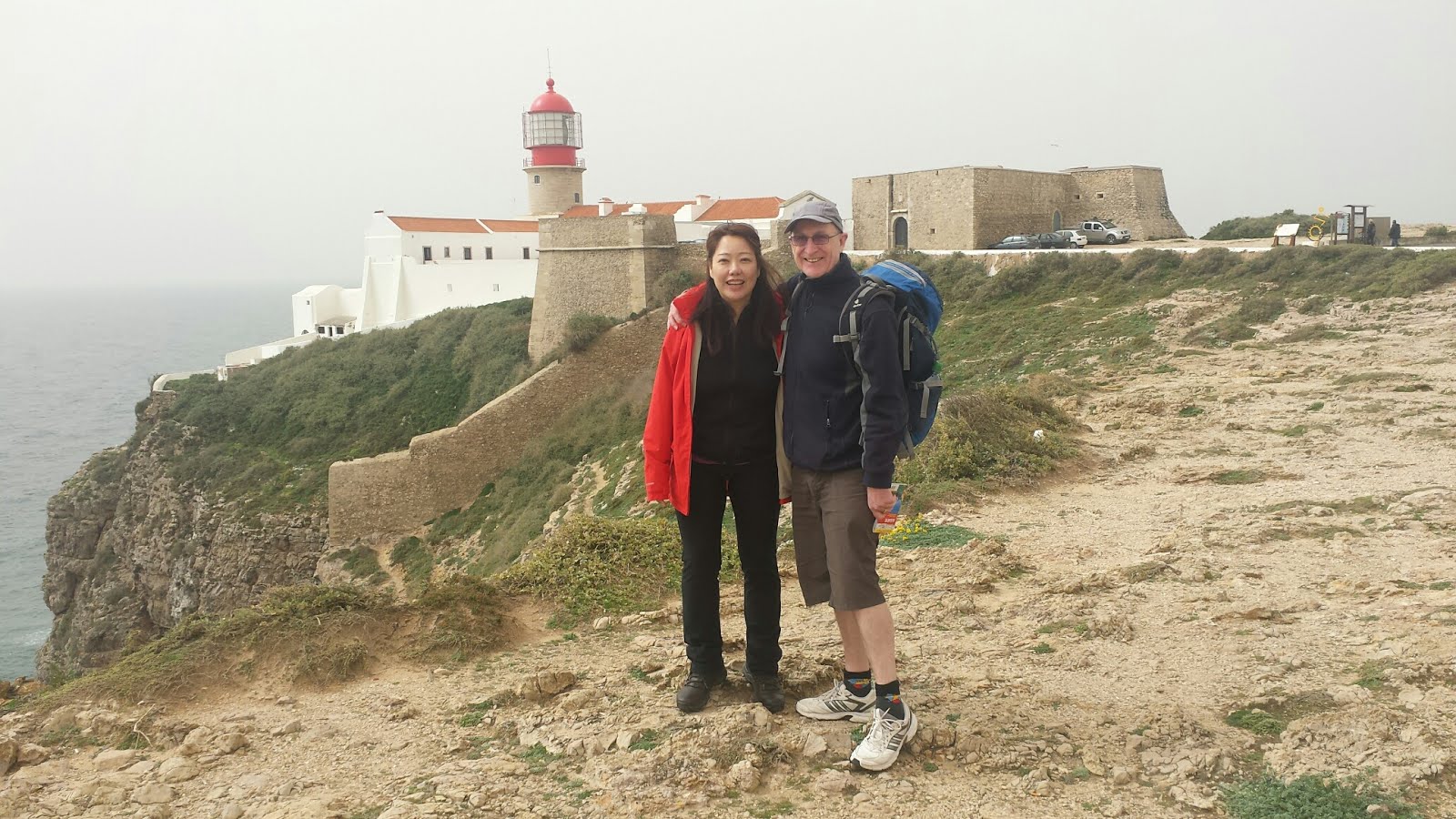
LIGHTHOUSE AT CABO DE SAO VICENTE
FORTALEZ DE BELICHE
RUINED CONVENT NEAR MONCHIQUE
FOIA SUMMIT
LOULE CENTRE
FLOAT REFLECTING CURRENT POLITICAL EVENTS
GREAT CARNIVAL COSTUMES
Thursday morning and our car, a Ford Focus, was delivered to us at the hotel. Our plan for the day was to drive to the western end of the Algarve along the N125. We had decided to avoid the A22 motorway because it is a toll road and, besides, we were in no hurry. Rubi did the navigation while I concentrated on driving on an unfamiliar side of the road. The hardest thing to get used to was changing gear with my right hand.

We passed Lagoa, Portimau, Lagos, Vila de Bispo and Sagres before reaching our target for the day - Cabo de Sao Vicente with its lighthouse above impressive cliffs. This is effectively the 'Land's End' of Portugal. We took a stroll around the lighthouse compound and ate our picnic by some sculptures of sea life before commencing our return journey.

We stopped at the remains of the ruined Fortaleza de Beliche nearby, and followed some metal poles that led us down the cliffs to the sea. We also took a look at the facade of Fortalez de Sagres, but didn't go inside.

We finally got back to the hotel at 5.30pm, and happily found a parking space just near the entrance. Supper comprised a medley of pasta, sausage, cheese and vegetables.

Friday's weather was predicted to be the best of the week - perfect for climbing Foia, at 902m the highest mountain in the Algarve. We drove to the village of Monchique, north-west of Albufeira, and parked the car. I had printed a map of the area before leaving the UK, so armed with this and a compass we headed upwards.

We soon reached a derelict convent where a man who seemed to be gardening outside ushered us in to take a look. The roof looked pretty dodgy and we weren't convinced the site was all that safe. Nevertheless it was an interesting aside and we gave the man €1. He, in turn, offered us an orange out of a big bucket.

As we continued our walk I became concerned that the route was not quite in the direction my compass said it should be, but since we were still ascending I didn't worry too much. Eventually we came to a point where I could properly establish our location. We were in the wrong place, but getting back onto the correct path was easy and took only about 15 minutes.

We could see the antennae that identified Foia ahead of us and in a short while we were sitting on a pile of rocks by the summit eating our lunch. Although a little hazy, the vista to the south from our viewpoint was amazing. It was pleasantly warm and we had certainly chosen the right day to do this.

It had taken us about two hours to ascend Foia, but our walk back to the car was much quicker, in part because we followed the correct route this time.

The following day's drive was to see a carnival at Loule. Even before we left the UK, Rubi had discovered that we would be visiting Portugal during the carnival season (Mardi Gras being on Tuesday 28th), and she spotted a poster advertising the Loule event as soon as we arrived at the hotel.

Loule was but a short drive away. We parked at the edge of the town and walked into the centre. The carnival parade would not start until 3.00pm, but it was clear that a huge amount of effort and expense had gone into preparations, with banners, a stage, lights, TV cameras and even a drone with a camera overhead. Police and security men were everywhere, but everyone was well behaved.

We found a pleasant park nearby to enjoy lunch and give our ears a brief rest from the loud music booming out the speakers. By the time we returned, the centre was filled with people in fancy dress and the floats were beginning to arrive. The carnival procession was behind barriers that we had to pay €2 to pass through, but the spectacle was well worth it. The floats were incredibly well designed and really amusing. We particularly liked the one showing a caricature of Putin blowing Donald Trump out of a cannon towards figures of Barack Obama and Hillary Clinton.

There were lots of people in costume playing musical instruments or dancing on and around the floats. Some of the girls were extremely scantily clad and a few topless, but naturally I averted my eyes.

The procession was slow moving and it took over an hour to pass, but all the floats were so good that we didn't want to miss a single one. We eventually headed back to the car at about 4.30pm for an unhurried drive back to the hotel. The day had been great fun.

Saturday, 25 February 2017

ALBUFEIRA, PORTUGAL

APARTHOTEL PALADIM
OURA BEACH WITH CLIFFS BEYOND
A ROSE BETWEEN TWO CACTI
FRIENDLY LOCALS
MUSICIANS IN THE OLD TOWN
I'VE GOT A LUVERLY BUNCH OF 'NANAS
By the middle of January, the Xmas and New Year breaks seemed but a distant memory. A foreign holiday beckoned, but we wanted to preserve some of our holiday fund for later, so where could we go that was warmer than the UK and cheap?

After a bit of searching on the Internet we chose Albufeira in Portugal's Algarve. Buying everything separately, the cost was a mere £400 for the two of us. That's flights, 7 nights in a self-catering apartment, car hire for 4 days, car parking at Gatwick and transfers from Faro airport to our apartment! Bargain! Departure was set for Tuesday 21st of February.

Daytime temperatures in the Algarve at this time of year are typically around 13 degrees C - cool for the beach brigade but fine for us walkers. However, as the time for our departure drew closer it became apparent that our stay was going to coincide with a bit of a European heatwave, and we would be treated to temperatures exceeding 20 degrees. Perfect!

Catching our 6.30am flight to Portugal involved a very early start to the day but, after an uneventful journey, we were being dropped off outside the Aparthotel Paladim in Albufeira by 11.00am. Our room wasn't ready but we were able to leave our bags and, armed with a street map given to us by the receptionist, start exploring the town.

We quickly located the supermarket, the beach and the 'Old Town'. The sun shone upon us, as expected, although a cool sea breeze coming over the Atlantic ensured that we kept our jackets on.

Back at our lodgings mid-afternoon to check in, we were pleased to find that we had a spacious room with a kitchenette, dining area and balcony. The early start seemed to suddenly catch up with us the moment we tested the beds - we both nodded off and didn't awake for 3 hours. By then it was getting dark, but we coaxed ourselves out to the supermarket to get provisions for the next couple of days. One counter was selling freshly roasted chicken. Along with a few vegetables and with few shakes of piri piri sauce, this served as a delicious supper back in our room.

Next morning we decided to do a much more extensive tour of Albufeira. We walked east from our lodgings to see the so called 'Strip', which is where all the bars and night clubs are. It was all pretty quiet on a February morning though. We then walked down to the beach at Oura, fending off a keen timeshare salesman on the way. The idea was to walk back along the full length of the beach as far as Albufeira harbour, but cliffs appeared to block our way.

On closer inspection we could see a path weaving its way through the highly eroded yellow sandstone cliffs, so we thought we would try our luck. It took us about an hour to make our way through, but this turned out to be great fun and a highlight of the day.

The cliff walk behind us, we continued along the beach and eventually reached the harbour and the marina beyond. Making our way back, we enjoyed a drink at a beach-side bar and picked up some more roast chicken from the supermarket before returning to our lodgings. Nothing wrong with having the same meal two day's running when it is this tasty.