 |
| PLAS CURIG HOSTEL |
 |
| SNOW NEAR FOEL-GOCH |
 |
| ME & TOM ROUTE-FINDING AROUND THE OGWEN VALLEY |
 |
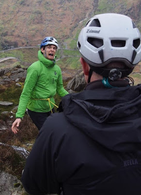
| PAUL (ASSESSOR) & TOM: A BREAK ON OUR SCRAMBLE UP TO LLECHOG |
 |
| TOM HAD TOTAL CONFIDENCE IN MY ROPEWORK |
 |
| LLYN COWLYD |
 |
| WILDCAMP NEAR FFYNNON LLYFFANT |
 |
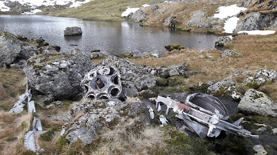
| REMAINS OF CRASHED BOMBER NEAR FFYNNON LLYFFANT |
 |
| COMMON FROG SEEN ON NIGHT NAVIGATION EXERCISE |
 |
| SUPPER OUT OF THE DRIZZLE NEAR AFON ANAFON |
 |
| ALL OVER: ME, PETE (ASSESSOR) & TOM |
This is an adventure for me only while Rubi was busy at work. The dates 13th to 17th March have been prominent in my mind for a while, because these are the dates I booked for my 'long time coming' Mountain Leader (ML) assessment. This is the culmination of about a decade of thinking about it, then five years ago signing up with Mountain Training (the awarding body for qualifications in walking, climbing and mountaineering). Two years ago I took a week-long training course in Snowdonia with Paul Poole Mountaineering and now I have returned to Paul for the Assessment Course.
The course assesses the skills required to lead groups in the mountains, including planning, understanding weather forecasts, navigation, safety & risk assessment, use of a rope, environmental knowledge and group management. There was only one other candidate on the course: Tom from nearby Conwy. Thus, the pair of us had the almost undivided attention of Paul and his co-assessor Pete - not much chance of our mistakes going unnoticed then!
I arrived at Capel Curig in Snowdonia on Sunday 12th, and stayed for three nights at the very smart Plas Curig Hostel. On Monday, after examining our pre-course 'homework' in the warm confines of Moel Siabod Cafe next door, Paul drove us to the Ogwen Valley for some navigation exercises. Though foggy at times, it was a surprisingly pleasant day for this time of year. Tuesday involved some scrambling practice and the assessment of our skills with a rope. Wednesday, Thursday and Friday were spent with Pete on a two-night expedition in the eastern Carneddau. This initially involved using 1:25K OS maps to navigate ourselves to a wildcamp near Ffynnon Llyffant, a lake just below Carnedd Llewelyn. After a hot supper, Pete tested our ability to navigate in the dark before we settled down for the night.
Thursday saw us navigating with less detailed 1:50K maps across some Carneddau peaks to a sheep-fold near Afon Anafon. It drizzled for a substantial part of the day and the droplets of water on my glasses made it extremely difficult to read the map at all, let alone see some of the finer details. Pete was very tolerant of my constant attempts to wipe my glasses (invariably unsuccessfully as they simply smeared) and my struggle to maintain precision. Fortunately my distance vision is fine, so I could still avoid us getting lost by simply looking over the top of my glasses whilst walking.
After a cold night wildcamping in the sheep-fold, the three of us walked out of the hills to be picked up by Paul in his car and taken back to Moel Siabod Cafe. After Pete and Paul had their pow-wow about our performance, I was pleased that both Tom and I were invited to receive our feedback together as this implied that we had both either passed or failed. Since I had seen how well Tom had performed, I guessed the news would be good for both of us. Thus, we were both congratulated on having successfully completed our Mountain Leader assessment. Handshakes all round! I thanked Pete and Paul for their excellent guidance and advice, and Tom for his good company, before departing.
It would have been a five hour drive home had I not discovered that my smartphone was missing. I normally 'check the ground, and my pockets' before leaving a campsite, but assumed that I had somehow left it in the sheep-fold. However, on driving back to where Paul had picked us up I immediately saw it on the ground where his car boot had been. It had clearly fallen out of my pocket whilst loading the rucksacks into his car. Finding it had cost me an extra hour but the phone was undamaged. Thus, having attained my ML and been happily reunited with my smartphone, I drove the rest of the way home with a broad grin across my face.


