Monday, 21 August 2017

BELFAST & HOME

ALBERT CLOCK

TITANIC BELFAST

SAMSON, OR IS IT GOLIATH?

PROW OF HMS CAROLINE

BOBBY SANDS MURAL OFF THE FALLS ROAD

CUPAR ROAD AND THE PEACE WALL

ULSTER VOLUNTEERS MURAL IN SHANKILL ROAD

MEMORIAL TO BAYARDO PUB BOMBING

KENILWORTH CASTLE

KENILWORTH CASTLE GARDENS
It was about 8.00pm by the time we found somewhere to stay on Saturday night. We had checked out possibilities in Killyleagh on Strangford Lough without success. We then drove back a short distance to a Camping and Caravanning Club site in Delamont Country Park that we had previously passed.

The site managers, Gill and Paul, were initially a little uncertain about letting us in as we were sleeping in a car and people might see us changing! When I explained we had curtains, cooking facilities and a mattress they relented and let us stay as 'backpackers', and charged us what it would have cost to pitch a tent. We had time to eat supper before the light failed and then made use of the excellent warm showers before turning in for the night.

We were much refreshed when we continued on to Belfast in the morning and, being a Sunday, we were able to park right in the city centre. Passing the Albert Memorial on the way, we decided to take a stroll to the Titanic Quarter, named after the ill-fated liner that was built here. We walked through the impressive Titanic Belfast building, a visitor and information centre located by the Titanic's slipway, saw the huge Harland and Wolff cranes named Samson and Goliath, and finally reached HMS Caroline, the sole surviving warship to have fought at the Battle of Jutland in 1916.

Most of the remaining day was spent exploring the decks of HMS Caroline and learning about its history and the Battle. The Captain's and other officer’s cabins were furnished just as they would have been 100 years ago. It was so interesting that we only just got round the cruiser before one of the staff announced they were closing.

We walked back to the city centre and ate in a Wetherspoon pub before looking for somewhere to car-camp for the night. We ended up sleeping in the car park of Cairnshill Methodist Church which was just around the corner from Cairnshill Park & Ride, which was where we left the car the following morning.

Our final day in Belfast involved catching the bus from the Park & Ride to City Hall, and then walking to the west side of the city where much of what we heard on the news during 'The Troubles' took place. The weather was wet and dreary but we managed to dodge most of the showers.

Our route took us initially up Grosvenor Road until we reached the infamous Falls Road, which is synonymous with the Republican community in the city. There were many political wall murals to be seen as we followed the Falls Road north east, some honouring republican heroes, some commemorating victims of Unionist attacks and some condemning Britain and the British Army.

A short distance after the IRA Memorial Garden we turned left up Cupar Road, passing through the now (hopefully) permanently open gates that separate the Republican and Unionist communities. The boundary that separates the communities runs along Cupar Road and is called the peace line. The high walls of the peace line are almost entirely covered with yet more murals, but many of them had a much more conciliatory message than those in the Falls Road.

We eventually reached Shankill Road, as infamous in the news as the Falls Road, and walked eastwards back towards the city centre. As before, there were many wall murals to be seen, but this time with Unionist messages. We spent some time at the extensive Memorial to the victims of the Bayardo Bar massacre. Union Jacks and Northern Ireland flags were in abundance pretty well the whole length of the road.

Whilst what we saw in Derry very much emphasised the human rights issues that fuelled the troubles, in Belfast the nationalistic differences were much more in evidence. We did not see very much evidence of a clash of religious beliefs, but since Unionists were generally Protestants and Republicans generally Catholics, it could certainly look that way.

We finally reached the city centre and, following a little shopping, caught the Park & Ride back to Cairnshill.

Our ferry from Belfast to Liverpool, the Stena Mersey, would be leaving at 10.00pm so we didn't waste too much time in driving back into Belfast, this time to the ferry port. I had booked a cabin for the overnight crossing so, once aboard, we had a quick look around the passenger deck, ate some food in our cabin and went straight to sleep.

All too soon we were being rudely awakened by the loud speaker and asked to be ready to go to our cars. We were making our way south out of Liverpool by 7.00am.

To break up the five hour journey home we decided to visit Kenilworth Castle near Coventry on our way. We arrived at the English Heritage site just after opening time at 10.00am. There was much to find out about the history of the castle, but most interesting was that the most recent sections were built by Robert Dudley, 1st Earl of Leicester, in order to entertain Queen Elizabeth I in the hope of marrying her. Although this didn't happen, they remained lifelong friends until his death.


It was a gloriously sunny day, perfect for exploring a place which, in the main, lacked a roof. Rubi dozed in the passenger seat as I drove the final miles home after what had been a terrific holiday and learning experience.

Friday, 18 August 2017

GIANT'S CAUSEWAY & MOURNE MOUNTAINS

GIANT'S CAUSEWAY
OLD BUSHMILLS DITILLERY
JOEY DUNLOP MEMORIAL IN BALLYMONEY
ROBERT DUNLOP MEMORIAL
BEN CROM RESERVOIR FROM BUZZARD'S ROOST
VIEW WEST FROM SLIEVE DONARD
VIEW SOUTH FROM SLIEVE COMMEDAGH
We left Derry and promptly made our way via Portrush to Bushmills, some 40 miles to the east. Old Bushmills Whiskey is distilled here and the business claims to be the oldest licensed distillery in the world. The town is also an ideal place from which to commence a walk to the Giant's Causeway. After a comfortable night in the town centre car park, this is exactly what we planned to do.

The morning's weather was warm and sunny; perfect for our coastal walk. A slight delay arose when I thought I had lost my toilet bag in the car park toilet. I could swear blind that I had left it by the sink. The car park attendants were most sympathetic and offered to keep an eye out for it. Imagine my embarrassment when I discovered that I had left it in the car. I didn't have the courage to tell them.

So, slightly later than intended, we made our way on foot the one and a half miles down to Portballintrae to join the coastal path. We then followed this east for about two and a half miles until the Giant's Causeway came into view. The Causeway is about 40,000 interlocking basalt columns formed by volcanic activity some 50 to 60 million years ago. They are Northern Ireland's biggest tourist attraction, so we were not surprised to find ourselves joined by huge numbers of people as we got close. Most of these were flowing down from the National Trust Visitor Centre. The Trust is a bit sneaky as it gives folk the impression that they have to pay £10.50 each to see the Causeway, whereas those who do their research soon discover that it is free to walk there.

After the usual photo session by the basalt columns, Rubi and I walked back to Bushmills. As we passed the Visitor Centre we found that you have to pay the National Trust £10.50 even to use the loo or cafeteria. Needless to say we crossed our legs and found another loo at the narrow gauge railway station nearby. By following the route of the railway track back to Bushmills our return trip was only two miles long.

Back at the car park, we had time to either drive a little further east along the coast to cross the famous Carrick--a-Rede rope bridge, or pay a visit to the Old Bushmills Distillery. The latter option won. It was an interesting tour, and the provision of a dram or two of Irish Whiskey at the end of it enabled us the recover the cost.

It was time to move on, and we wanted to drive south to the Mourne Mountains. That would be too far for the remaining daylight hours, but a place called Ballyronan on the western shore of Lough Neagh looked like a promising overnight stop. Lough Neagh is the largest freshwater lake in Northern Ireland, with an area of 151 square miles. It supplies 40% of Northern Ireland's water.

Along the way we passed through Ballymoney where a sign indicated that we would be passing the Dunlop Memorial Garden. As an ex-biker, I was interested to find out if this had anything to do with the Dunlop motorcycle racing dynasty. It turned out that Joey Dunlop, winner of 26 Isle of Mann TT's before dying in a crash in 2000, was born in Ballymoney, and the Memorial Garden was originally for him. However, when his brother Robert, who had 5 TT wins also died during racing practice in 2008, the garden was extended to include memorials to them both. Robert's sons Michael and William, continue to race.

We reached Ballyronan around 9.00pm with just enough light remaining to cook supper. In the morning we continued south, initially to Armagh where we stopped for an hour to look around, and then to Warrenpoint from where we followed the Mourne Coast Route which loops around the south of the Mourne Mountains. Our final destination for the day was Newcastle, County Down, a small town compared to the much bigger city in England.

There didn't seem to be any objection to us staying overnight in any of the car parks in Newcastle, although we became a bit selective when we discovered that the local youths used some of them as meeting places and race tracks during the evenings.

We had planned to walk to the summit of Slieve Donard, at 850m Northern Ireland's highest mountain, but Friday 11th was drizzly and the wind rather brisk. Instead, in increasingly thick fog, we walked from Carrick Little car park up to the tor-topped summit of Slieve Binnian (747m), mainly following the line of the Mourne Wall. This a drystone wall built between 1904 and 1922 to keep cattle and sheep out of the Silent Valley Reservoir catchment area. We then struck north along the ridge to Buzzard's Roost. As the fog cleared we got some good views of Ben Crom Reservoir and Blue Lough before looping back to Carrick Little for a warming drink in the delightful coffee shop nearby.

Saturday's weather was much better so we followed a route from Newcastle along the Glen River until we reached another section of the Mourne Wall. We then followed the line of the wall up to the summit of Slieve Donard. The good weather had encouraged lots of other folk to do the same thing so the route was busy. From the top we were able to take in the spectacular views out to sea and to the west as we enjoyed our sandwiches. In order to avoid the crowds on the way down, we took a different route which involved climbing a second summit, Slieve Commedagh (767m) before descending via Shan Slieve (671m). This route gave us a whole new set of marvellous views to the north and east.

Our six and a half hour walk was a great success, but it was now evening and we needed a shower. We jumped in the car and headed in the direction of Belfast.

Thursday, 10 August 2017

DUNGLOE TO DERRY

SUNDAY MORNING IN DUNGLOE CHURCH CAR PARK
MOUNT ERRIGAL IN GLENVEAGH NATIONAL PARK
MUSICIANS AT GLENVEAGH CASTLE
ROBERT, OUR HOST AT ARAS OWEN HOSTEL
BEACON & FORT AT CULMORE POINT
PEACE BRIDGE IN DERRY
FREE DERRY WALL
MALIN HEAD
WALL MURALS IN DERRY'S BOGSIDE AREA
Of course, staying the night in a church car park on a Saturday night is inevitably going to lead to a rude awakening. Fortunately, we were ahead of the throng, but when they did come the car park was packed. Religious lot these Irish! We had popped our heads around the doors to the church the previous evening and it was huge inside, and it needed to be.

After a bit of local shopping (Dungloe had an Aldi, a Lidl and a sort of Co-op) we departed without having learned who would be crowned Mary. That ceremony would be held in the evening, hosted by famous Irish singer Daniel O'Donnell himself.

We were leaving the Wild Atlantic Way for a while and heading for Glenveagh National Park in central Donegal. A huge conical mountain came into our field of view as we approached the park. This intimidating monolith was Errigal Mountain. Although very steep, it was climbable from the east. However, the rain and fierce wind dissuaded us from leaving the car to attempt such a thing. As we drove deeper into the park we discovered that it had a castle (yes, really) so we decided to take the two and a half mile walk to that instead. Even then, we got a drenching half way there. The castle was actually a stately home built in the Scottish Baronial style by, John Adair, an Irishman who had made his fortune in America. From 1938 it was owned by Henry McIlhenny who in 1979 gave it to the Irish State so that the National Park could be created. A particularly noteworthy feature is its magnificent gardens which are still being developed.

Continuing our drive, we reached Letterkenny to rejoin the Wild Atlantic Way heading north towards the Inishowen Peninsula. Shortly after Buncrana we arrived at Dunree Head. Amid fears of a Napoleonic invasion, Fort Dunree was built here in 1813 to protect the approaches to Lough Swilly. Huge guns were added in 1895 and Lough Swilly became the marshalling area of the Royal Navy's Grand Fleet. Admiral Jellicoe's fleet was anchored here prior to the Battle of Jutland in WW1. The fort was handed over to Ireland in 1938 and decommissioned after WW2. In 1986 it was opened to the public as a museum.

It was time to consider finding somewhere to stay the night and as we were passing through Ballyliffen I spotted a sign for Aras Owen Hostel. There were no cars to be seen on the drive and initially I thought the hostel was closed until a gentleman waved at me through the window. He introduced himself as Robert and invited Rubi and me to view a choice of two rooms. These he offered at a rate that suited our pocket, so Rubi chose the room with the picture window and the beautiful northward-facing view. The hostel had kitchen facilities enabling us to make our evening meal and breakfast. The kitchen, our room and indeed the whole house were spotlessly clean and Robert was a wonderfully friendly and helpful host. When we left the next morning we both had the feeling that we might like to return there sometime.

I suppose that it was inevitable that our northward quest would eventually take us to the most northerly point of mainland Ireland, Malin Head. It was a popular spot, with many visitors, a bit like Land's End in some ways, but rather more attractive in my view. We were lucky to have good clear weather and we could even see Scotland in the distance. We spent a while walking along the cliffs and taking pictures before deciding it was time to move on.

It was downhill from here on, in the sense that having reached the most northerly point, we can now only go south, even though the Wild Atlantic Way signs still indicated (N) for north. I guess it would get rather confusing if they made the signs too literal.

As we drove down to Stroove we enjoyed the spectacular view of Magilligan Point whilst eating a late lunch. Then we drove down to the beach at Inishowen Head. Finally we followed the east coast of the peninsula to Muff. Just beyond there we found the single tower of Culmore Fort on the bank of Lough Foyle. We agreed that this would be an excellent place to car camp.

We were close to the border between the Irish Republic and Northern Ireland, so when we refuelled the car in Muff next morning we were given the choice of paying in Euros or Sterling. As we drove south to Londonderry (or Derry as preferred by nationalists) the only indication that we had left the Republic was that the speed limits were in mph instead of kph.

We found a free car park on the west bank of the River Foyle and from there walked across the Peace Bridge into the city. We wanted to learn more about 'the troubles' that beset Londonderry from the late 60's through to the 90's, so headed to Rossville Street in the Bogside area. There we saw the murals and memorials that now serve as a reminder to many events, both historic and tragic. We spent some time in the Museum of Free Derry, which has been erected adjacent to the site of the Bloody Sunday massacre where British Paratroopers killed 14 innocent protesters.

Londonderry is also referred to as the Walled City, having a complete city wall, built between 1613 and 1618 as defences for early English and Scottish settlers. After a substantial lunch in the Richmond Shopping Centre we went to Bank Place and climbed the steps up to the top of the 1.5km long wall, then walked anticlockwise around it to enjoy the views it offered over the city. There are 24 ancient cannon on the wall in a good state of preservation, some of which were used in anger during two 17th century seizes.

As we walked back to the car we both agreed that our perception of the Irish 'troubles' had changed and that, whilst nationalistic and religious motivations played a significant part, at the core was a fight for human rights.

Monday, 7 August 2017

DUBLIN TO DUNGLOE

VIEW FROM JOYCE'S MARTELLO TOWER IN DUN LOAGHAIRE
TRIM CASTLE
CAR CAMPING BY RIVER ERNE
ENNISKILLEN CASTLE
MULLAGHMORE HARBOUR
MOUNTBATTEN MEMORIAL, MULLAGHMORE
FISHING BOATS AT KILLYBEGS
FESTIVAL IN DUNGLOE
OUTSIDE DUNGLOE PUB
Much refreshed on Thursday morning, we enjoyed an excellent breakfast at Tara Hall before venturing out to the waterside just a few minutes' walk away. We soon came across a Martello Tower in which the famous Irish author and poet James Joyce had briefly stayed. Neither of us had read any of his work (his most well known books being Dubliners, Ulysses and Finnegans Wake), but the exhibition within the Tower helped us appreciate his experimental use of language even if we failed to understand it.

We left Dun Loaghaire around midday to head north west. Rubi navigated us out of Dublin without us inadvertently straying onto the toll roads that encircle the Irish capital. Our first stop was Trim. This town was chosen simply because it was a suitable place to take a lunch break on our way to Enniskillen. It turned out to be a lucky choice because it is also the location of the largest Anglo-Norman castle in Ireland, and was used during the filming of Braveheart in 1994. Hundreds of Trim locals were employed as extras and Mel Gibson, who starred as William Wallace, was granted the Freedom of Trim in 2010.

By the time we were approaching Enniskillen it was time for us to look for a suitable spot to car camp. Luck was with us again because we quickly found an ideal location in a car park in Bellanaleck, right next to a marina on the River Erne. Supper was enjoyed by the moored boats, as was breakfast next morning.

The following day's drive initially took us to Inneskillen where the free town car park turned out to be right next to Enniskillen Castle (yes, yet another one). This one was really well looked after and contained all manner of historical artefacts, both military and archaeological, which kept us occupied for a couple of hours. We took a walk around the town, visiting the Buttermarket, had lunch on the green by the car park, and then departed for our next destination, which was Sligo.

We didn't actually stop in Sligo but just took a brief detour around it in the car before heading northwards along the coast. We stopped at the pretty harbour at Mullaghmore. It was only a few hundred yards out from the harbour that Lord Louis Mountbatten was assassinated in 1979 when a bomb, secreted aboard his boat Shadow V by the IRA, was exploded by remote control. We took the short walk to see the simple wooden memorial cross placed on the cliff overlooking Donegal Bay.

Our drive continued through Bundoran, Ballyshannon and Donegal. We would be following sections of a road route called the Wild Atlantic Way for the next few days.

By the time we reached Killybegs it was time to find a place for the night, and a free car park with no restrictions suited the purpose. Initially we were alone, but a short while later two more vehicles turned up with the same idea.

We explored Killybegs in the morning and discovered that it is Ireland's main fishing port, its catch being exported to many other countries. The deep natural draft of the harbour is suitable for the largest trawlers. From the new pier, built in 2004 at a cost of €50M, we watched a fishing boat come in and prepare to unload its catch. We would have liked to stay longer but the process was slow and it was time to move on.

We had intended to visit the cliff top viewpoint at Slieve League, but missed the turning. There were so many other places to enjoy beautiful views that it wasn't worth turning back. We stopped near Rossan Point instead.

Our target for the day was Dungloe, which we reached via Andara and Glenties. It was Saturday 5th of August and it turned out that we had arrived in the middle of the 50th Annual Mary from Dungloe International Festival. Lovely girls, both local and from other countries, but presumably with Irish roots, compete to be crowned 'Mary' for the year. In the town centre, there was an array of pictures of Marys going right back to 1968 in one shop window. We listened to a folk singer performing the song 'Mary from Dungloe' outside a pub. It is a lovely song that I knew well.

We made our supper in the car park of a local church and left the car there while we returned to the town centre in the evening to listen to duo, Danny & James, on the outdoor stage. Later back at the car, we decided to stay in the church car park overnight, ignoring the sign at the entrance that prohibited this. We reasoned that no right-minded Christian would kick us out in the middle of the night.

Sunday, 6 August 2017

CAPEL CURIG TO DUBLIN

FRIENDLY DUCKS AT CAPEL CURIG CAMPSITE
CRIMPEAU SUMMIT
DUBLIN'S VERY OWN MOLLY MALONE
ON HA'PENNY BRIDGE, DUBLIN
CUSTOM HOUSE, DUBLIN
GUINNESS OUTSIDE GOGARTY'S BAR
MANCHESTER UNITED FANS IN HIGH SPIRITS
Tuesday the 1st of August and it was drizzling in the morning. Furthermore, the forecast predicted fog at altitude, so no views to be had if we climbed to one of the higher peaks. With no clear goal we took our time to get up and have breakfast. A group of ducks were wandering around the campsite and when they saw us eating they headed our way. They seemed to greatly appreciate the wholemeal bread and bran flakes that we offered.

The weather seemed to be improving.

A short distance from the campsite is an Ellis Brigham shop which offers 50% discounts on quality walking clothing. After over an hour of rummaging through just about everything, Rubi picked out a lovely down jacket and I found an excellent waterproof jacket and trousers to replace some of my worn out gear. Since it would be my birthday soon, Rubi bought me the jacket as a birthday present. Looks like I will be well dressed for my next walking leader appointment for HF Holidays at the end of the month!

It was now well past midday, and the weather was perfect for walking. We parked the car at Cafe Siabod in Capel Curig and I quickly devised a 4 hour route, much of it 'off piste', which would take us to the 475m summit of Crimpiau. It turned out to be a mix of scrambling to rocky peaks, bog walking and sliding our way down steep fern-covered slopes to a more walkable return path. Back at Cafe Siabod just after 6.00pm we rewarded ourselves with one of the substantial meals they had on offer.

We would be catching the ferry from Holyhead to Dublin very early the following morning, i.e. 2.40am, so we made our way to Anglesea. We stopped at a Lidl just outside the ferry port to resupply.  Rubi then had a doze in the car park whilst I nipped round the corner to the pub.

Once on board the 'Ulysses' we found a quiet corner under some stairs where we could lay down on our sleeping bags and get some sleep during the overnight journey.

We were driving off Ulysses by 6.00am and navigating our way through already busy Dublin streets to our pre-booked B&B at Dun Loaghaire (pronounced Dun Leary), 10km south of the ferry port.

We knocked on the door of Tara House Accommodation just after 7.00am to be greeted by Mike who told us that we were not expected until the following day and that they were full. Since the booking was made on the phone it was impossible to say whose mistake this was, but he did offer to tidy up a spare room which we could use if we didn't insist on en-suite bathroom facilities. We didn't want the hassle of looking elsewhere and the price he quoted was attractive so we accepted his offer.

We left our bags, parked the car and walked down the road to the nearest DART (Dublin Area Rapid Transport) railway station which took us quickly into Dublin City centre where we would spend the day. After a hearty breakfast at Kilkenny's store, we walked through the grounds of Trinity College, paid a visit to Molly Malone's statue and crossed Ha'penny Bridge. A walk along the north bank of the River Liffey took us Custom House, completed in 1791, which is now the home of the Department of Housing, Planning, Community and Local Government. Inside was a fascinating exhibition about its design and construction, then destruction by the IRA in 1921 and its subsequent rebuilding by the Irish Free State.

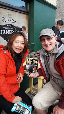
Walking back past the Famine Memorial then along the south bank we reached Temple Bar and found a seat outside Gogarty's bar where I could enjoy a Guinness. The cost of this was (in sterling) an excruciating £6 so I didn't complain about the £3 cost of Rubi's small glass of lime and soda. The bar opposite Gogarty's was packed full with rowdy Manchester United football fans so we guessed that they were here for an away game.

Given our early start and the limited sleep we had the night before, by the time the DART took us back to Dun Loaghaire we were in serious need of some good rest.

Thursday, 3 August 2017

ELAN VALLEY TO CAPEL CURIG

CABAN COCH DAM
REMAINS OF NANT-Y-GRO DAM
WINDY BARMOUTH RAIL BRIDGE
OUR HARLECH CAR-CAMPING SITE
HARLECH CASTLE
AMAZING VIEWS FROM HARLECH CASTLE BATTLEMENTS
SITTING ON PONT-Y-PAIR BRIDGE IN BETWS-Y-COED
We had a restful night sleeping in the car at the Claerwen dam car park. Following breakfast we made our way back to another car park by the top of the Caban Coch dam, which is the one that immediately overlooks the Elan Valley Visitor Centre. I was keen to visit the site of yet another dam which involved a short walk along the other side of the Caban Coch Reservoir. This small dam, the Nant-y-Gro, was constructed around 1890 to provide water for a temporary village built to house the families of the workers building the main dams. By 1942 it was no longer required so it was used instead to conduct experiments to determine how much explosive would be required to breach it. This led to the development of the Bouncing Bomb, conceived by Barnes Wallis, which was deployed in the Dambusters raid to attack the Ruhr Valley dams a year later. The resultant flooding of Germany's industrial heartland significantly disrupted arms production for some months. The Nant-y-Gro dam was never rebuilt.

After a final look around the Elan Valley Visitor Centre, we headed west for a quick tour of Aberystwyth (dodging the rain) after which we continued on to Barmouth.

For Rubi and me, the most notable attraction in Barmouth is the railway bridge that crosses the River Mawddach estuary. There is a walkway attached to the up-river side of the bridge so a return crossing of its 699m span on foot seemed like a pleasant way to spend the early evening.

Our final goal for the day was to reach Harlech. We planned to visit the Castle the following day, but for now we just needed to find a discreet place to car-camp. Just as we parked in a suitable clearing up the road from Harlech Castle, the owner of the adjacent property turned up with his dog. He was in the process of bringing in his chickens for the night. A chatty gentleman, he not only confirmed that it was fine to park where we were, but he brought us a half a dozen eggs.

In the morning we fried a couple of our newly acquired eggs before walking down to the Castle, which was only half price to enter because of our English Heritage membership. It played a significant role in various conflicts between the English and Welsh, and its superb location offered spectacular views towards the sea from the walls and turrets.

Next, we drove further north into the heart of Snowdonia, initially looking around the outdoor shops in Betws-y-Coed and finally settling for the night at Dolgam camp site in Capel Curig. The weather forecast for the following morning kept changing, but we hoped that it would be suitable for a hill walk.

Wednesday, 2 August 2017

DESTINATION MID-WALES

FARLEIGH HUNGERFORD CASTLE
MAKE SURE YOUR HEAD-TORCH IS SWITCHED ON!
LOOK WHAT I FOUND DOWN THE MINE
HEADSTONES OF ABERFAN DESISTER VICTIMS
MONMOUTHSHIRE & BRECON CANAL
LOOKING FOR JAMES CORFIELD IN BUILTH WELLS
CLAERWEN DAM
A MINI INVASION
Thursday 27th July; I locked up the house and we departed for Wales at 11.15am. After driving for 10 minutes I remembered that I had left my computer on.

Rubi and I left the house for the second time at about 11.35am.

Thus commenced 19 days of driving through Wales to Holyhead, crossing over to Dublin on the ferry, heading up to the north western corner of the Irish Republic, zigzagging our way in a generally easterly direction through Northern Ireland to Belfast and then returning to England on the overnight ferry to Liverpool. Along the way we intend to visit as many new (to us) and interesting places as we can fit in.

Our destination on the first day was Pontypridd where my son, David, daughter-in-law Lisa and three of my Grandchildren live.

On the way, however, we visited Farleigh Hungerford Castle, making full use of our recently acquired English Heritage membership. The castle is a ruin now, but the stories about the fortunes of the Hungerford family were fascinating, particularly the one about Lady Agnes murdering her first husband and using the bread oven to dispose of the body.

We reached David and Lisa's house in the early evening to the excitement of Grandchildren Oliver and Saffir. Cai was away canal-boating so we were able to use his room.

Lisa had to work on Friday so David drove the rest of us to Pwll Mawr, Welsh for Big Pit, in Blaenavon. This disused mine is now preserved as the National Coal Museum, and a hugely interesting visitor attraction it is. Saffir was just tall enough to be permitted to descend in the cage with the rest of us. Equipped with head torches, we were guided through the tunnels and enlightened as to what it would have been like to work down a coal mine. Pretty grim by all accounts. Up until the mid 1800's, the children of miners, some as young as five, were employed as 'trappers' to open and close the tunnel doors in the pitch dark for 12 hours a day, all for the paltry wage of two pence a week. They didn't usually see the money though since their fathers would normally collect it along with their own wage.

The following morning we said farewell to the family and drove to Aberfan where, on 21 October 1966, a colliery spoil tip collapsed killing 116 children in the local school and 28 adults. There is now a Memorial Garden where the school was. A short distance away is the cemetery, where headstones in the form of stone arches identify the graves of the victims.

We continued northwards and stopped at Brecon for a brief tour. Continuing along the A470, we also stopped at Builth Wells, where they were searching for a missing teenager. Sadly, a body was found in the local river the following day which was later identified as that of James Corfield, the missing boy.

We then proceeded to the Elan Valley Visitor Centre near Rhayader. This beautiful area is the location of five reservoirs that were constructed to provide clean water to the Birmingham area. One of the dams, the Claerwen, was built in 1946 and its construction involved the use of Italian stonemasons since all the British ones were busy repairing the House of Commons and other buildings in London following the Second World War.

We found a quiet car park where we could sleep in the car near the Claerwen dam - at least we thought it would be quiet. Shortly after we had eaten supper what seemed like an endless stream of Minis came tearing into the car park, and then parked side by side in neat rows alongside us. Apparently this was some International Mini owners club on an evening jaunt. It was quite a spectacle, but we were happy to see them go so that we could get some sleep.